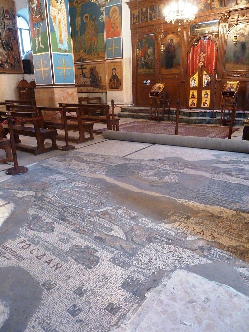

In the middle of the 19th century, during the construction of a Greek Orthodox church in the city of Madaba (Jordan), the remains of an older structure, the early Byzantine church of St. George, were discovered. The most interesting part of this building, built in the 6th century, is the mosaic floor with a map depicting the Holy Land. The Monk Arcadius mentioned the find in his letter (1884) addressed to Patriarch Nikodim I of Jerusalem. Two years later, Arcadius’ successor, the Monk Ignatius, also sent a letter to the Patriarch, telling about the amazing floor image with inscriptions in Greek. In the next 10 years, the mosaic was not touched, and only in 1896 the first studies were carried out here.
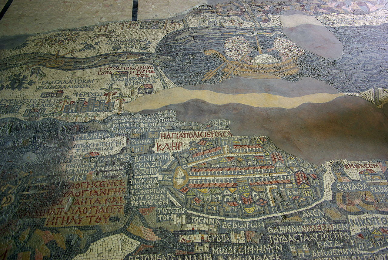
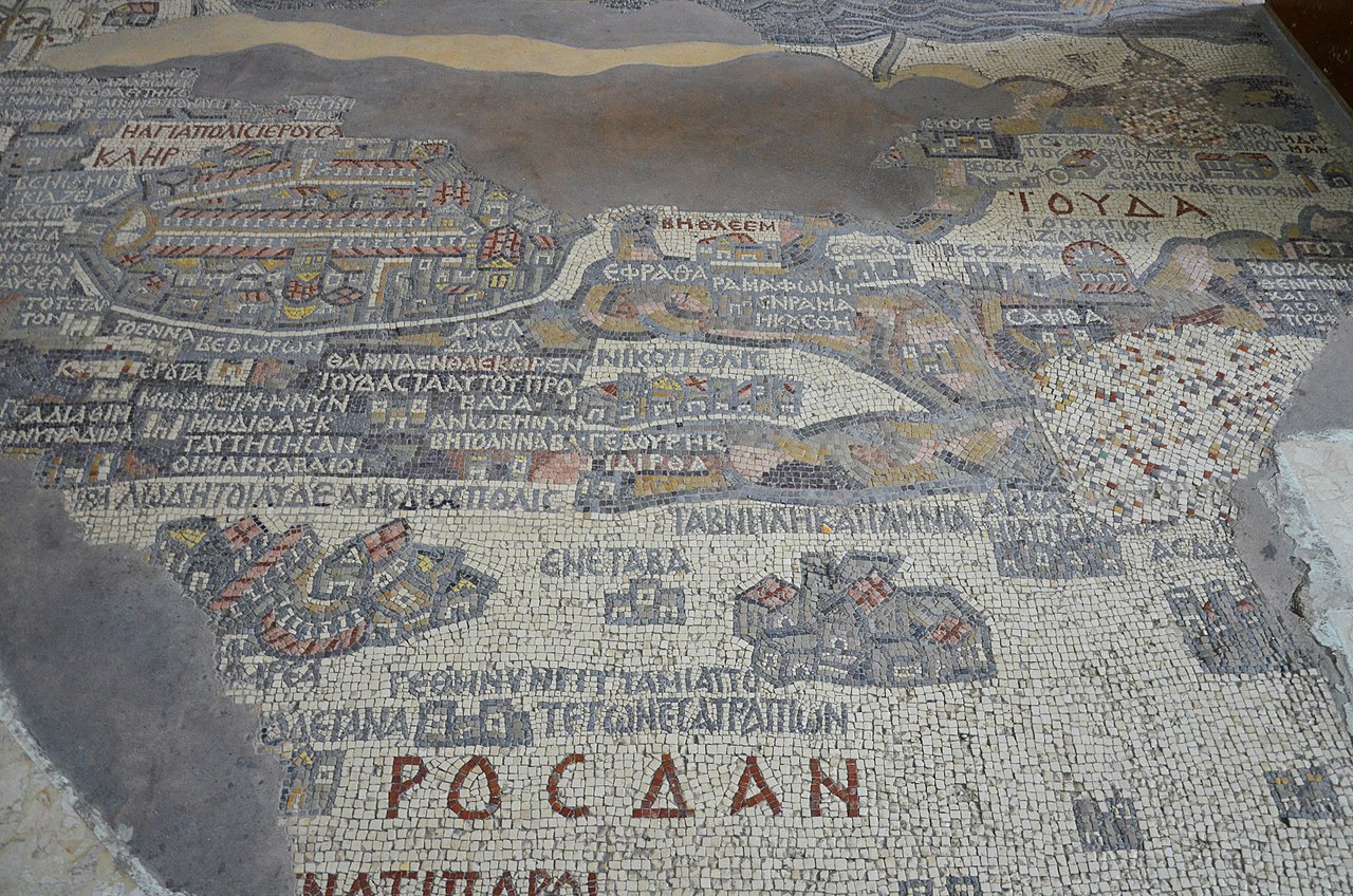
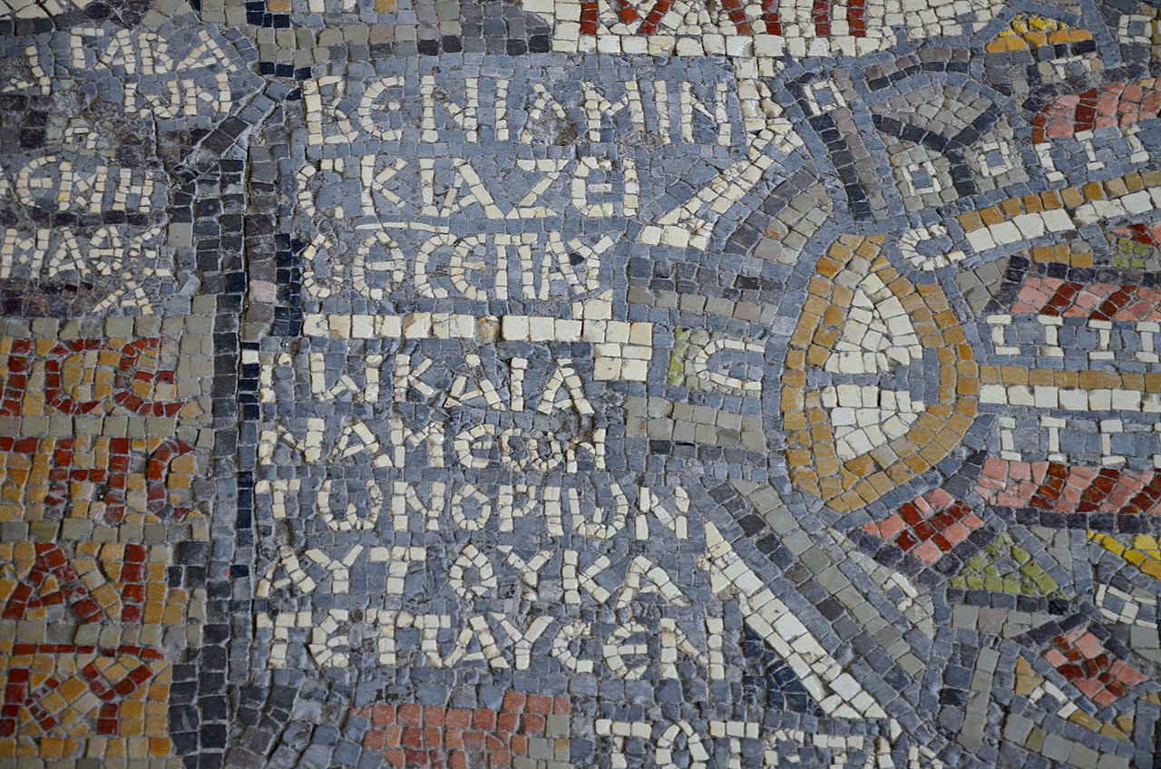
The mosaic was probably laid out in the residence of the bishop of the Christian community in Madaba. Byzantine artists depicted Jerusalem on the map with the New Church of the Theotokos, built during the reign of Justinian I. This part is the largest and well-detailed: you can see the Damascus Gate, the Church of the Holy Sepulcher, the Tower of David and other significant architectural objects. Around the center are other areas, including part of Lebanon, the Nile Delta, the Dead Sea, the Jordan, the banks of which are connected by bridges. Perhaps this map helped the pilgrims navigate the Holy Land, which they were unfamiliar with. It is believed that when making inscriptions on the map, the authors of the work used the Onomasticon of Eusebius, an ancient directory of place names.
At the beginning of the 7th century, Madaba was captured by the Sasanian Empire, and the Muslims destroyed part of the mosaic. The city was later damaged by a strong earthquake. Even after its discovery, the mosaic map survived several fires. In 1964, the German Palestine Exploration Association (Deutscher Verein zur Erforschung Palästinas) received enough funding to save the artifact. In 1965, the restoration and subsequent conservation of the remaining fragments of the map began.
Today, the mosaic can be seen in the church of St. George in Madaba. Initially, the picture consisted of 2 million tesserae - small mosaic cubes. Over the past years, its size has decreased from 21x7 meters to 16x5 meters. Recognized as the oldest known geographic map floor mosaic, it is still used today to locate ancient structures and roads.